Iwate prefecture
Information
Iwate Prefecture is located in northern Honshu. The interior western border of Iwate consists of the Ou Mountains, a range that stretches about 500km down the spine of Honshu, a third of the length of the entire island. To the east, Iwate faces the Pacific Ocean on its Sanriku coast, featuring a unique geology of mountains dropping into the sea. Here is the “Rias coast”, a deeply indented coastline of small bays and coves.
Access
Iwate can be accessed from all major cities via its domestic airports and stations on the East-Japan Railway Company (JR-East) Tohoku Shinkansen line.
5 MUST-SEE spots
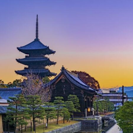
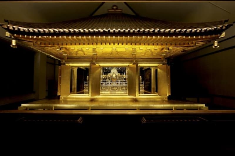
Chusonji

Tendai sect, Tohoku Dai Honzan. The honorific mountain name prefixed to a temple’s name is Kanzan, and Jikaku Daishi is the founder of the mountain. At the beginning of the 12th century, Fujiwara no Kiyohira, the founder of Oshu, built many temples such as the Taho-pagoda and the Nikaidaido. The purpose was to build the land of France by mourning the spirits of those who died in the long war. The temple pagoda was unfortunately burned down in the 14th century, but it is a treasure trove of Heian art that conveys more than 3,000 national treasures and important cultural properties, including the Konjikido.
Information
Contact name : Chusonji Secretariat
Location : 202 Hiraizumi Koromonoseki, Hiraizumi-cho, Nishiiwai-gun, Iwate Prefecture 029-4195
Hours of use : Summer (3 / 1-11 / 3) 8: 30-17: 00, Winter (11 / 4-2 / end) 8: 30-16: 30
Admission fee : 800 yen for adults, 500 yen for high school students, 300 yen for junior high school students, 200 yen for elementary school students
Phone number : 0191-46-2211
FAX number : 0191-46-2216
home page : https://www.chusonji.or.jp/launch
Hachimantai

Hachimantai City was born in September 2005 by the merger of Nishine Town, Matsuo Village, and Ashiro Town. This place is blessed with beautiful scenery in each season, with mountains such as Hachimantai, Mt. Iwate, and Appi Kogen in the national park.
Attracted by such magnificent natural beauty, many tourists visit Hachimantai City throughout the four seasons every year.
Sightseeing spots include Mt. Iwate, one of the “three major rime trees in Japan”, “Hachimantai Rime”, Iwate Prefectural Forest, Sakura Park, Matsukawa Gorge, etc.
Information
Inquiries: Hachimantai City Commerce, Industry and Tourism Division Tourism Promotion Section
Location: 21-170 Noda, Hachimantai City, 028-7397
Phone number: 0195-76-2111
Fax number: 0195-75-0469
Coastal area
The coast of Iwate Prefecture, where the Oyashio and Kuroshio meet, is one of the three fishing grounds in the world. And this is a treasure trove of fresh seafood. Not only can you enjoy the seafood of each region, but the scenery created by Sanriku’s unique terrain, such as Kitayamazaki, which has 200 meters of cliffs, Unosu Cliff, and Jodogahama. Jodogahama is designated as a national scenic spot. These amazing views are just overwhelming.
Information
Location: 〒026-0043 6-50 Shinmachi, Kamaishi City, Iwate Prefecture
Phone number: 0193-25-2701
FAX number: 0193-23-3472
Morioka Castle Ruins Park (Iwate Park)

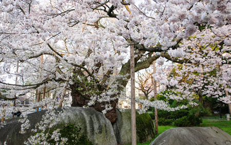
The historic site of Morioka Castle, which was the residence of the southern feudal lord. Morioka Castle was completed in 1633, the era of the 28th feudal lord Shigenao.This flat castle utilizes the Kitakami River, Shizukuishi River, and Nakatsugawa as natural moats. And this was also called Fukukata Castle. Currently, stone walls and ponds remain, and it is popular with the citizens throughout the four seasons as Morioka Castle Ruins Park.

There are cherry blossoms in spring, colored leaves in autumn, plum grove, etc., and various trees and flowers color the four seasons.
Information
Contact name: Morioka Tourism Convention Association
Location: 〒020-0023 Maru, Morioka City, Iwate Prefecture
Phone number: 019-604-3305
FAX number: 019-653-4417
Homepage: https://odette.or.jp/launch
Highlights: [Spring] Plums from late March to early April, [Spring] Fuji May, [Summer] Hydrangea July
Geibikei
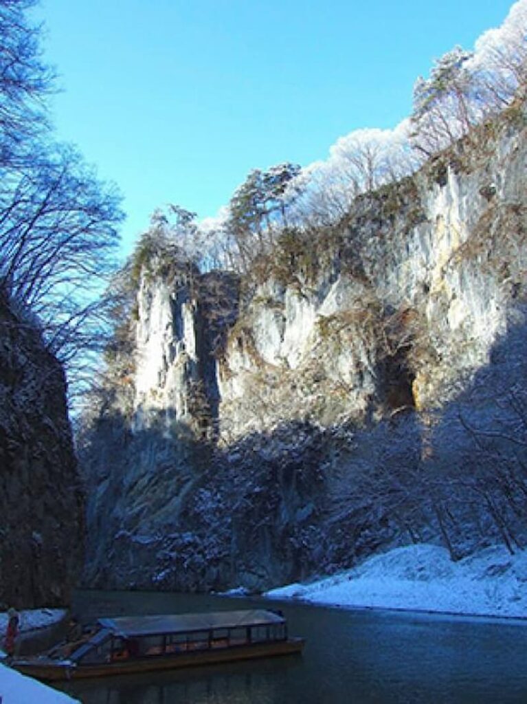
One of the 100 Landscapes of Japan. This valley is about 2 km long and has been formed by the erosion of limestone by the Satetsu River, and cliffs with a height of about 100 m rise on both banks. The flow is quiet, and when you go down the boat, you can hear “Geibikeiwake”, where the captain skillfully manipulates the boat with a single rod and sings.
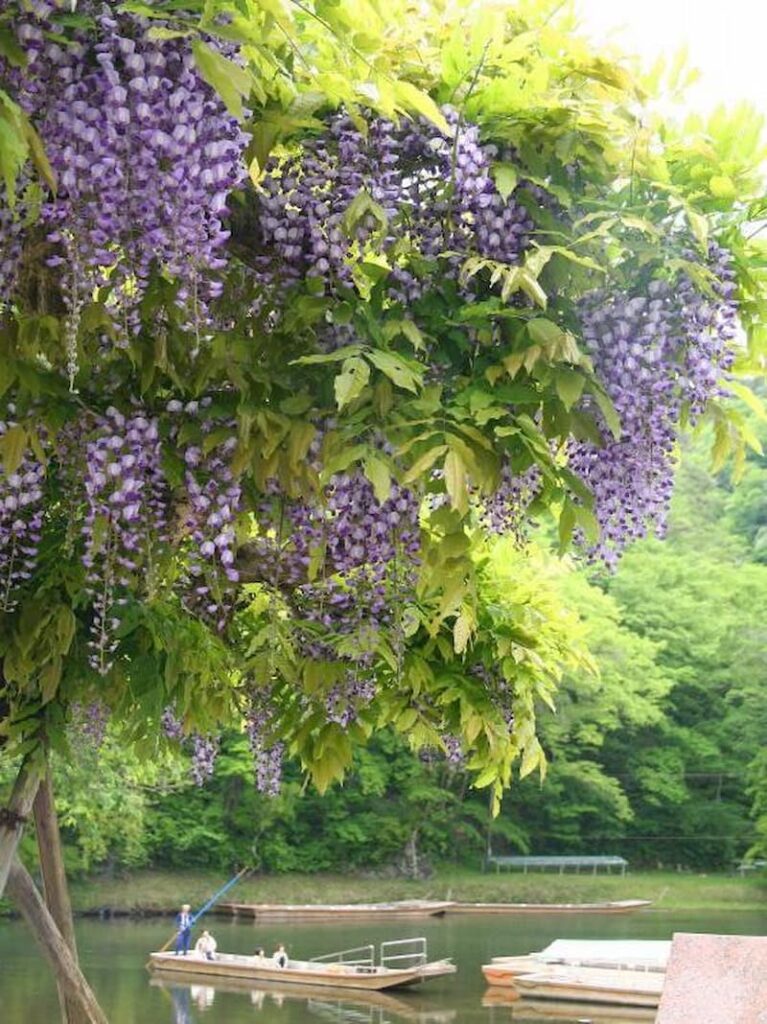
In addition, the wisteria flowers that bloom purple flowers on this cliff are the highlight of spring. Especially the wisteria rocks that rise along the clear stream have many bright purple tufts hanging down during the flower season. There is also a wisteria shelf on the way to Geibikei, and it looks good in the fresh green.
Information
Contact name: Geibi Tourist Center
Location: 467 Nagasaka-cho, Higashiyama-cho, Ichinoseki-shi 029-0302
Admission fee Boating fee: Adults 1,800 yen, elementary school students 900 yen, infants 200 yen
Phone number: 0191-47-2341
FAX number: 0191-47-3288
home page: http://www.geibikei.co.jp/funakudari/launch
Highlights: [Spring] Fuji from late May to early June